
The Government of India has considerably built up the country’s national ocean observation network in recent times. Here’s a closer look at what that network now includes.
For monitoring ocean currents and zooplankton biomass, and to feed critical data into ocean model validation, 19 subsurface moorings have been deployed, 16 of them within the mainland Exclusive Economic Zone (EEZ) and 3 in the equatorial Indian Ocean.
Watching for Tsunamis Around the Clock
On the tsunami front, the Indian Tsunami Early Warning System now runs on 17 broadband seismic stations, 7 deep-ocean tsunami buoys, and 36 coastal tide gauges, supported further by 35 Global Navigation Satellite System (GNSS) receivers and strong-motion accelerometers.
Keeping Watch Along the Coast
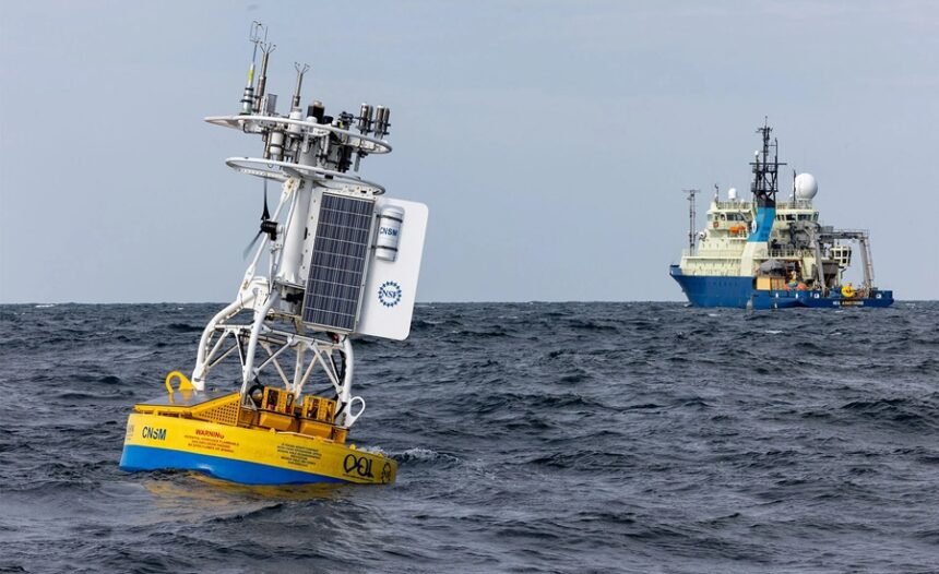
Coastal and ocean conditions are tracked continuously by the Indian National Centre for Ocean Information Services (INCOIS), which maintains a network made up of 17 Directional Wave Rider Buoys, 20 Acoustic Doppler Current Profilers (ADCPs), 32 Automatic Weather Stations (AWS), 2 Water Quality Buoys, and 50 tide gauges.
Reaching Into the Deep Ocean
Going further offshore, INCOIS has deployed 302 Argo profiling floats between 2014 and 2025, alongside 12 deep-sea glider missions, 45 drifting buoys, and 64 wave drifters. The network also includes advanced instruments such as Vertical Microstructure Profilers (VMPs), Underway Conductivity–Temperature–Depth (uCTD) systems, and Wire Walker systems.
Sharper Forecasts, Thanks to Better Data
All of this added observational capacity has meaningfully improved the accuracy of monsoon prediction, cyclone forecasting, and ocean-state forecasts, largely because it feeds high-quality, real-time data into numerical weather and ocean models. Readings from Argo floats, moored buoys, tide gauges, and other ocean-observing platforms all flow into INCOIS through the Global Telecommunication System (GTS), where they’re quality-checked and then assimilated into numerical models to generate accurate starting conditions for ocean forecasts.
This assimilation process cuts down forecast errors and makes monsoon and cyclone predictions, along with ocean-state forecasts, more reliable. INCOIS also draws on real-time wave data from these buoys to run its operational wave forecasting and coastal early warning services.
Recent Additions to the Network
The network hasn’t stopped growing. Recent additions include 14 new tide gauges and 15 co-located GNSS receivers, meant to sharpen tsunami monitoring and coastal observation. A Directional Wave Rider Buoy has also been placed off Mauritius specifically to improve predictions of Southern Ocean swells that affect India’s north coastal waters.
On the operational side, pre- and post-monsoon research vessel cruises have now become a regular, institutionalized practice for deploying and maintaining these ocean observation systems, and collaboration has deepened with the Council of Scientific and Industrial Research – National Institute of Oceanography (CSIR–NIO), the National Centre for Polar and Ocean Research (NCPOR), and other partner institutions, to keep the network running and growing sustainably.
The Numbers Behind the Improvement
The payoff from all this real-time data assimilation is measurable. Wave forecast accuracy has improved by roughly 43% compared to 2014 levels, with these gains holding steady across the full five-day forecast window. Coastal forecast systems, built on this stronger observation network, now achieve about 70% accuracy. And when it comes to tsunamis, data from the buoys, tide gauges, GNSS receivers, and strong-motion accelerometers lets INCOIS issue tsunami advisories within the required 10-minute window after a tsunamigenic earthquake, in line with international standards.
How the Data Feeds Into Forecasting Models
Real-time data streaming into INCOIS from these ocean observation platforms gets assimilated into the INCOIS Global Ocean Data Assimilation System (INCOIS-GODS), which supplies the starting ocean conditions used by the Coupled Forecast System (CFS) for seasonal and extended-range forecasts.
It also feeds the Hybrid Coordinate Ocean Model (HYCOM), which in turn provides initial ocean conditions for the Hurricane Weather Research and Forecasting (HWRF) model that the India Meteorological Department (IMD) relies on for cyclone prediction. Together, these systems have substantially strengthened the country’s monsoon and cyclone forecasting capabilities.
Key Takeaway: India’s expanding ocean observation network reflects a major strengthening of the country’s marine monitoring and disaster preparedness capabilities through the deployment of advanced platforms for observing ocean currents, waves, sea levels, weather, and seismic activity. Led by INCOIS and supported by institutions such as CSIR–NIO and NCPOR, the integration of real-time data into advanced forecasting models has significantly improved the accuracy of monsoon, cyclone, coastal, and ocean-state forecasts while enabling tsunami advisories to be issued within internationally mandated timelines.
By combining satellite, in-situ, and geospatial observations with data assimilation technologies, the network enhances early warning systems, supports scientific research, and reinforces India’s capacity for coastal disaster risk reduction, maritime safety, and sustainable ocean governance.
M.C.Q.
Question 1: With reference to the Indian Tsunami Early Warning System, consider the following statements:
- It uses deep-ocean tsunami buoys and coastal tide gauges for tsunami detection.
- It is operated by the Indian National Centre for Ocean Information Services (INCOIS).
- It is capable of issuing tsunami advisories within internationally prescribed timelines.
Which of the statements given above is/are correct?
- A. 1 only
- B. 1 and 2 only
- C. 2 and 3 only
- D. 1, 2 and 3
Question 2: Argo profiling floats, frequently mentioned in oceanographic studies, are primarily used to:
- A. Detect earthquakes beneath the ocean floor.
- B. Measure ocean temperature and salinity profiles for improving ocean and climate forecasting.
- C. Monitor marine biodiversity through underwater imaging.
- D. Track commercial shipping routes in the Indian Ocean.
Read More: Education Overhaul: NEP 2020’s Complete, Game-Changing Push